Outsmarting Earth's Killer Crust

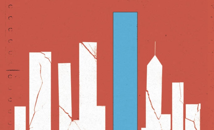
Building to Survive Earth’s Killer Crust
Earthquakes can’t be stopped or predicted, but they can be understood. Research by UT Arlington scientists and engineers shows promise in mitigating the types of disasters that recently devastated Japan and Haiti.
On a pleasant March afternoon earlier this year, Paul Hayashi and his dog were taking one of their twice-daily strolls along red brick footpaths in a picturesque neighborhood park in Katori, Chiba Prefecture, Japan. Dr. Hayashi, an economics professor emeritus who retired in 2002 after 35 years at UT Arlington, returned to his native Japan in 2004 with his wife.
That little park is a haven of serenity undisturbed by Tokyo’s massive Narita International Airport nearby and the crush of a population exceeding 30 million in Greater Tokyo on the island of Honshu. But at 2:46 p.m. March 11, 2011, as Hayashi and his dog ambled toward a rose garden, the land suddenly pitched and rolled in violent undulations that lasted about 10 seconds. They had to sit down on the heaving ground.
“I could not stand still,” he says.
Hayashi instantly recognized an earthquake. He grew up with quakes and aftershocks. Japan annually endures 1,500 quakes of varying intensity, the seismic consequence of Earth’s colossal, unpredictable tectonic mess.
Like an eggshell broken into jagged pieces, Earth’s crust comprises 15 major slabs of rock 50–250 miles thick. These tectonic plates float in all directions at up to 20 centimeters a year, colliding with and sideswiping and overlapping each other. In time, their stressed boundaries can rupture, releasing pent-up energy.
On March 11 off Honshu’s northeast coast, extraordinary stress had built up in a fault where the vast Pacific plate slides beneath the North American plate and Japan itself, according to a United States Geological Survey (USGS) analysis. In an instant, the fault fractured, thrusting up into the sea 130 feet along an area 190 miles long and creating a monster—the fifth-largest earthquake in recorded history.
“I could not believe I was experiencing an earthquake of that magnitude,” Hayashi says. “It was frightening. When I returned home, my wife and I talked about how bad the earthquake was. Our dogs were so frightened that they refused to go to their room.”
The Hayashis soon learned that the epicenter of a magnitude 9.0 quake was just 231 miles northeast of Tokyo, where observers described high-rise buildings swaying like trees in the wind.
Worse, a massive quake-spawned tsunami breached seawalls at the Fukushima Daiichi nuclear power plant 150 miles north of Tokyo. Inundated, the plant lost power, which led to a meltdown in three of its six reactors. The tsunami washed away tens of thousands of structures and virtually everything in its path—factories, shipping operations, transportation systems—along hundreds of miles of coastline and for miles inland.
The twin disaster left 25,000 people dead or missing and an official estimate of at least $259 billion in damage. A catastrophic blow to life and commerce, including the auto and high-tech industries, it left Japan’s economy reeling.
MINIMIZING THE DESTRUCTION
There’s no stopping or predicting such events. But a detailed understanding of plate tectonics and related matters is emerging that can help anticipate them. Meanwhile, earthquake-focused research explores construction materials and techniques that should vastly improve the ability to withstand a quake’s violent impact. Four UT Arlington faculty members are immersed in these labors.
DAMAGE CONTROL
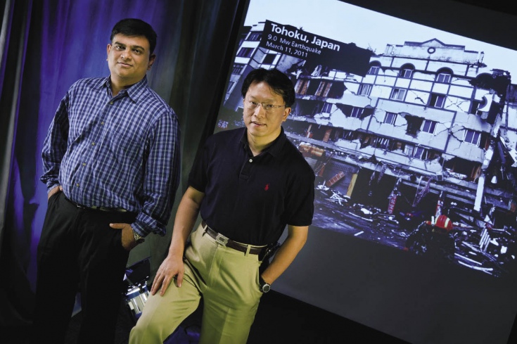
Anand Puppala, left, and Simon Chao collaborate on projects to help buildings withstand violent shaking.
Professor Pamela Jansma, dean of the College of Science, specializes in neo-tectonics, examining the movement of Earth’s crust to find ways of predicting earthquakes. Her husband, earth and environmental sciences Professor Glen Mattioli, uses satellite and terrestrial geodetic techniques to study earthquake– and volcanic-induced ground deformation.
Shih-Ho “Simon” Chao, assistant professor in the Department of Civil Engineering, concentrates on developing designs and construction materials to better withstand violent shaking. A native of seismically active Taiwan, Dr. Chao was inspired to pursue his Ph.D. after experiencing a 7.7 quake in Taiwan in 1999 that irreparably damaged 10,000 buildings, killed 3,000 people, and left more than 100,000 homeless.
He sometimes partners with soil expert Anand Puppala, a distinguished teaching professor of civil engineering. With two grants, including one from the National Science Foundation Major Research Instrumentation program, Dr. Puppala is researching how expansive soils are tested and how to simulate earthquake loading on unsaturated soils. Findings could lead to improved construction practices.
“New technologies, design methods, and materials could minimize the losses in life and property.”
He also collaborates with Associate Professor Laureano Hoyos on developing a triaxial testing tool to measure soils’ reaction to seismic-type dynamic loading in different moistures.
All work with a sense of urgency, well aware of the worldwide toll in death, destruction, and economic loss. Last year alone, the USGS recorded 21,541 quakes that killed 226,729 people—the deadliest year since 2004. This year’s Great East Japan Earthquake drew intense interest from the UT Arlington faculty members.
Chao notes that limited damage in Tokyo reflected how Japan’s earthquake experience has led to highly advanced building codes and engineering. California, riddled with geological faults, needs more materials and innovative engineering like Japan’s in preparation for “the big one” that’s expected at any time, he says.
Chao is principal investigator for an engineering team that, with a $1 million, three-year NSF grant, is researching the earthquake resistance of reinforced concrete buildings and how they react in extreme conditions, issues about which “there are many unknowns.”
Much of the research is under way at the University of Minnesota’s Multi-Axial Subassemblage Testing Laboratory, where the effects of an earthquake can be simulated. There, researchers can shake reinforced concrete beams until they collapse.
The work examines a building’s survivability when high-performance steel fibers replace most conventional rebar in concrete. In related work with a $600,000 NSF grant, Chao is looking for designs in steel trusses that will make them practical for buildings constructed in earthquake-prone locales. He hopes to provide engineers, architects, and others in related industries with new approaches to the seismic design of structures.
“New technologies, design methods, and materials could minimize the losses in life and property,” he says.
MAXIMIZING SURVIVABILITY
That’s an essential step toward society’s ability to survive earthquakes, Mattioli says. “It’s not the ground shaking that kills people. It’s the falling objects” as buildings, bridges, dams, and other structures collapse.
“Surviving earthquakes is related to vulnerability and is largely a socioeconomic/political issue. But since most of the world’s population lives very close to major convergent or strike-slip boundaries capable of generating magnitude 8.0 events, and most of the world’s population is poor, the exposure to earthquake hazard is increasing and therefore so is the risk.”
That sketches conditions in much of the Caribbean, where Drs. Mattioli and Jansma have long focused their research. Their urgency increased after the 7.0 earthquake that rocked Haiti in January 2010.
That temblor, the worst in the area in 200 years, devastated the western hemisphere’s poorest country and its capital, Port-au-Prince, which was 10 miles from the epicenter in an area where the vast Caribbean and North America plates meet. Collapsing structures, often built as cheaply as possible, caused many of the estimated 230,000 deaths, the displacement of 1.5 million people, and an estimated $8 billion in damage.
WHAT’S AT FAULT?
Pamela Jansma and Glen Mattioli found strong evidence that a previously unmapped fault caused the January 2010 earthquake in Haiti.
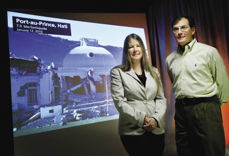
Much of downtown Port-au-Prince was reduced to rubble. Structures slid down deforested hillsides, crashing into and atop each other. An estimated 380,000 children were orphaned. Mattioli arrived in Haiti by Jan. 28 to gather data with a team of researchers from other universities.
“The devastation and human suffering were staggering,” he says.
The team blogged daily about its work and the quake’s aftermath. “There is no way to properly describe the level of destruction and havoc,” the researchers wrote. “It will be months before this city and many of those who perished will be dug out.”
As with Mattioli, Jansma was deeply saddened, but not surprised. She and her collaborators have worked in the northeastern Caribbean on active tectonics and seismic hazard for 20 years. “Hearing about the Haiti earthquake really hit home. I knew immediately that the devastation would be significant and traumatic.”
Just a year earlier, she, Mattioli, and a group of Purdue University scientists published a paper warning that Haiti faced the imminent threat of a strong earthquake. Another major event is likely, she says.
They collaborated with researchers at other universities to determine what triggered the Jan. 12 quake. Studying years of data, the scientists found strong evidence of the cause: the rupture of the previously unmapped Léogâne fault. Their resulting paper was published in the journal Nature Geoscience.
“What has become very apparent as a consequence of Japan and Haiti,” Jansma says, “is the increased risk that hazards present as the world’s population grows and that increased understanding and monitoring of hazards is essential to mitigate those increased risks.”
“It’s not the ground shaking that kills people. It’s the falling objects.”
A huge step forward involves refining the satellite-driven global positioning system, which transformed the field of neo-tectonics. From space, “we can now measure movements of Earth’s surface on the order of a few millimeters,” Jansma says. “This allows us to understand deformation processes at a level that was not previously possible.”
A significant advance in such capability is the Continuously Operating Caribbean GPS Natural Hazards Observational Network (COCONet), which creates a link of global positioning stations for the international geoscience community. Data is transmitted to an archive at Boulder, Colo.-based UNAVCO, a university consortium funded by the NSF and NASA.
Mattioli is a key player in shaping COCONet’s circum-Caribbean operation. He believes its prospects are excellent, noting Japanese scientists’ success with the 600-site GPS in their country. The system’s data helped project an 8.0 quake where the March 11 magnitude 9.0 quake occurred.
A major challenge is that preparation for such events, particularly in the construction industry, is far from perfect. Survivability can’t be assured. But as earth scientists and engineers press forward, they strengthen the ability to contend with seismic forces.
For Hayashi and all who are vulnerable to quakes, life goes on. He still takes his dog, Fluffy, on daily walks through the park, where damage was minimal. The rose garden is still there, and the red brick footpaths.
But so are the nearby tectonic powers that could destroy it all in seconds.